Introduction to Datasets 
By: TerrainDrop on July 31, 2022, 7:40 p.m.
Datasets are a grouping of images that are generally taken in one sitting. This could be multiple flights worth of data collection but the general idea is that the images are related and collected while taking off from the same location.
You can read about how to upload data in the Quick Start Guide.
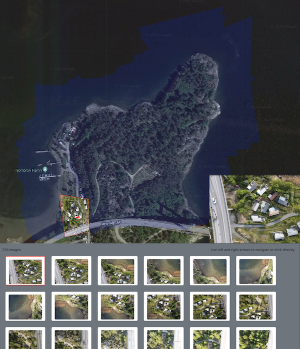
The dataset detail shows a map of the area with the footprit, information about how the imagery was collected with various settings and images that are part of the dataset. You can see that this dataset has 729 images.

You can click on any of the images at the bottom and it will show what the images were taken of. You can also use the left and right arrows on a keyboard to advance through the images one at a time. Swiping left or right on the image area will do the same thing on mobile interfaces.

Clicking on any location in the footprint will highlight all of the images the contain that location point. The images in the bottom are then filtered to include just the highlighted images.

This subset of images can be reviewed in the same way the full dataset can by clicking, arrows or swiping.
